


Best Solution for Creating a VR 3D/360 Tourist Tour of Hiking Trails?8546
Pages:
1
 WGAN Forum WGAN ForumFounder & WGAN-TV Podcast Host Atlanta, Georgia |
DanSmigrod private msg quote post Address this user | |
| Hi All, A WGAN Member emailed me the following. How do you suggest I reply later today (Thursday, 24 January 2019). Dan ---- Hi Dan, I wanted to try and scan some hiking trails and other exterior areas on our [location). I was looking at the BLK360 but the pricing is way out of my range at this point. Matterport isnt a good solution for this. Do you know of anything else? My goal is to create a VR area guide website will all kinds of VR solutions. Matterport, 360 video, 360 aerials etc. letting a viewer take a virtual hike on some of trails would be really cool too. Thanks in advance for any thoughts! [redacted] |
||
| Post 1 • IP flag post | ||

|
GarySnyder private msg quote post Address this user | |
| The simplest solution is to apply to Google for use of one of their backpacks and walk the trails. I know that many trails are already on Street View so the Redacted person can just add his or her trails to Street View and the problem is solved. |
||
| Post 2 • IP flag post | ||

|
kenangiguere private msg quote post Address this user | |
| Thanks Gary, I will look into that. | ||
| Post 3 • IP flag post | ||
|
WGAN Forum Founder & WGAN-TV Podcast Host Atlanta, Georgia |
DanSmigrod private msg quote post Address this user | |
| Hi All, I received this additional info ... Does this help you decide what to recommend and why? Dan --- Thanks Dan, The project will be commercial, but as I am just starting out on it, I will have to create a bunch of free content. The hiking trails and other points of interest would be free. I would sell Matterport for interior spaces of vacation rentals, houses for sale, businesses, wedding venues etc. I am setting up WP3D Models to use as the back end for the project and I hope to have it up and running by summer. I have a 4K 360Fly, but I’m not sure how that will work. I can try a Theta V too as I am trying to keep it on that end of the pricing spectrum. If the site eventually takes off, I am willing to spend what ever on equipment. This is a side project from my normal Matterport work which I am trying to expand and create demand. The hopes of this VR area guide will help drive demand up a bit! I am hoping to become a Google Street View trusted photographer soon, so maybe that can be the way I go about this. I also want to put a 360 camera on a drone for areal immersive tours. Thanks, [redacted] |
||
| Post 4 • IP flag post | ||
|
WGAN Forum Founder & WGAN-TV Podcast Host Atlanta, Georgia |
DanSmigrod private msg quote post Address this user | |
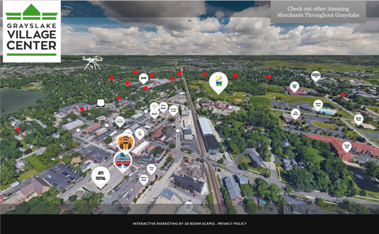 Screen Grab: Grayslake Village Center Interactive Marketing By 3D Room Scapes: How to Make Money with ThreeSixty Tours; Making Your Competition Irrelevant WGAN-TV How to Make Money with ThreeSixty Tours while Making Your Competition Irrelevant with Matterport Service Provider Ross Zanzucchi (@rzphotoman) with Grays Lake, IL based 3D Rooms Scapes. Video: NCTech Co-Founder & CTO Neil Tocher speaking at the 2018 Google Street View Summit | Video Courtesy of Google Earth YouTube Channel WGAN-TV Neil Tocher, co-founder and Chief Technical Officer of NCTech | Video courtesy of @TrustedPhotoDC Hi All, Here's my reply ... Best, Dan --- Hello [Redacted], Thank you again for reaching out. And, thank you for the additional backstory. Here’s my recommendation: 1. Buy an NCTech iStar Pulsar (the version for Google Street View only) + Backpack 2. Publish to Google Street View 3. Use Panoskin Pro to export the trail to your computer 4. Use Panoskin Custom Builder to annotate and sharing/embedding 5. Use ThreeSixty Tours as the platform for all your digital assets (Trail, Matterport 3D Tours of interior spaces, aerial 360ºs, photos, etc.) Note: WP3D Models seamlessly integrates with ThreeSixty Tours. 6. Use SatellitePanoramas.com to order 360º aerials. 7. You must watch these two episodes of WGAN-TV: ✓ How to Make Money with ThreeSixty Tours; Making Your Competition Irrelevant ✓ WGAN-TV - A Marketing Plan for Matterport Service Providers Living in a Vacation Destination (See your WGAN Welcome Onboard Letter for the password) The iStar Pulsar is exactly the right tool for capturing and publishing to Google Street View. If you knew that you were going to do a ton of 360º high-end video, you could substitute the Insta360 Pro1 or Pro2 – plus an external GPS – but it is likely you would be way happier with the workflow with the iStar Pulsar. Plus, thinking ahead, selling Google Map Updates – by the mile – is a great opportunity. (The next big thing.) (Read This Too) WGAN Forum Discussions tagged: Insta360 and Insta360 Pro2 If you decide to do the trail with a Ricoh Theta V, the challenge will be how to place the trail in the correct place on Google Street View. While the iStar Pulsar (and backpack, case, spare battery, etc.) is more than you want to spend, I could imagine that you could buy it for this project and sell it used, once done. WGAN Standard Members receive: ✓ the free use of Panoskin Pro ✓ free use of ThreeSixty Tours (White Label version) ✓ free use of WP3D Models WordPress Plugin ✓ free use of WordPress powered by Ionblade Pro ✓ free installation, configuration and training of WP3D Models (via WGAN rebate) ✓ special savings on SatellitePanoramas.com Compare WGAN Member Plans | www.JoinStandard.com Best, Dan WGAN Forum Discussions tagged: ✓ iSTAR Pulsar ✓ NCTech ✓ GSV18 WGAN-TV: How to Make Money Publishing to Google Street View with Google Street View Product Manager Charles Armstrong | Video: Paulo @Tosolini |
||
| Post 5 • IP flag post | ||
|
|
kenangiguere private msg quote post Address this user | |
| Thanks Dan! I appreciate you putting together this information | ||
| Post 6 • IP flag post | ||
|
WGAN Forum Founder & WGAN-TV Podcast Host Atlanta, Georgia |
DanSmigrod private msg quote post Address this user | |
| 360º Video: Trekking with the iStar Pulsar at the Fort Worth Design District | Video courtesy of @Metroplex360 YouTube Channel @kenangiguere From @Metroplex360 YouTube Channel (above) ... "We're updating Google Maps with NCTech's iStar Pulsar. We're capturing data based on GPS position that builds blue lines on Google Maps just like the Google car to update locations that do not appear on Street View!" Source: Metroplex 360 YouTube Channel Best, Dan |
||
| Post 7 • IP flag post | ||
Pages:
1This topic is archived. Start new topic?