


Google Street View Accepting Depth Data?4458
Pages:
1
 WGAN Forum WGAN ForumFounder & WGAN-TV Podcast Host Atlanta, Georgia |
DanSmigrod private msg quote post Address this user | |
Google Street View Example Hi All, This related Forum discussion got me thinking ... Is it possible that Google is – or will – start accepting scan data from 360º cameras to improve the viewing experience? Perhaps Google will announce this at the Google Street View Summit 10-11 May 2017 in Tokyo. As @qpoisson discusses in the related post, 3D-aware Google Street View for indoor scenes would add a ton to the user experience. Perhaps Google is accomplishing the same thing with photogrammetry? Your thoughts? And, do check-out this related Forum discussion. Best, Dan P.S. If I lost you, think about the difference between B&W TV and Color TV; or analogy TV and Digital TV; or Digital TV and 4K TV .... |
||
| Post 1 • IP flag post | ||

Frisco, Texas |
Metroplex360 private msg quote post Address this user | |
| @DanSmigrod -- When posting to Google Street View, you are able to place each pano on a map and this distance between each panorama is used to simulate movement / distance. This is, by the way, where the Street View app was a completely and miserable failure at the time it was released -- no spacial relation between tours. I think they've fixed that now by allowing you to awkwardly attempt to position panoramas on a tablet (yuck). Here's an example of a tour posted via GoThru that I built that shows a deep network of connections -- over 100 scans -- 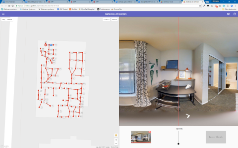 I think that in the example tour above -- it looks like the 3D transitions are the same on every tour and that given the linear nature of the tour following the shape of the building -- it looks PRETTY DARN SIMILAR to Matterport without using 3D data. Now, if Google were to use 3D data - it would allow Google to enforce walls and to allow people to more freely navigate within the space -- it would allow Street View to have the same immersive experience offered by Matterport. If Google were to do this, then Matterport would be the only platform on the market capable of submitting this information with any level of automation. I'm excited to listen to Matterport's announcement at Google's SV Summit -- but more excited to hear what Google themselves have to say -- as they've totally reorganized the program, built an API to serve as the gateway, and have likely cut off the tools that hold back moving forward. I sure @Alin and the Panoskin folks have a lot to announce too with their platforms -- likely things they have been under an NDA about that they are excited to bring to their publishing platforms. |
||
| Post 2 • IP flag post | ||
|
WGAN Forum Founder & WGAN-TV Podcast Host Atlanta, Georgia |
DanSmigrod private msg quote post Address this user | |
Quote:Originally Posted by Metroplex360 I could imagine that you (still) disagree with me on this ... ✓ Why Google Will Acquire Matterport Dan |
||
| Post 3 • IP flag post | ||
|
|
qpoisson private msg quote post Address this user | |
| @Metroplex360 it looks like that the proxy geometry used in the viewer is not a simple cuboid - i.e. the width of room is varying. I never used any google street view uploader. Does the uploader allow the user to input the room shape ? |
||
| Post 4 • IP flag post | ||
|
WGAN Forum Founder & WGAN-TV Podcast Host Atlanta, Georgia |
DanSmigrod private msg quote post Address this user | |
Quote:Originally Posted by Metroplex360 I could imagine that NCTech iris360 Pro and/or LASiris VR could do this as well. NCTech has announced an open platform - www.OneStopVR.com - that enables the publishing of the photography and data - to its "coming soon" platform. Seems like NCtech is well positioned to take advantage of publishing data to Google Street View - if Google adds data intake to Google Street View. Dan |
||
| Post 5 • IP flag post | ||
|
Frisco, Texas |
Metroplex360 private msg quote post Address this user | |
Quote:Originally Posted by DanSmigrod I think that Google opening up the API for Street View submission for all platforms doesn't really connect. Here's what I would look out for -- see if anyone working at Matterport gets a new job at Google. That's always the tell tale sign. Ben Goodger was the pioneer that worked from Netscape -- which was acquired by aol. Netscape was open sourced and Goodger led the development of the stand-alone Phoenix web browser which was later renamed 'Firebird' and finally Firefox. When Google wanted to get their own browser on the market, guess who was hired? Ben Goodger. I'd try to see if Google is sniping experts in the 3D Camera world as a good litmus of whether or not they are wanting to create a scenario that is 'like' buying Matterport. |
||
| Post 6 • IP flag post | ||
|
Frisco, Texas |
Metroplex360 private msg quote post Address this user | |
Quote:Originally Posted by qpoisson No, there's no opportunity to input any geometry. The tour you've posted is from May 2015 -- so it's 2 years old. There are 3D transitions on Google Street View and I believe that there is some photogrammy involved -- and perhaps information from the 3D Google Earth topographical stuff... I'm still on the fence concerning whether this tour is really using 3D data -- or if it just happens to REALLY look like it is due to the linear way it was scanned... i.e. optical illusion. |
||
| Post 7 • IP flag post | ||
|
|
qpoisson private msg quote post Address this user | |
| If you move cursor along the walls - especially where room's width changes, you will find that there exist planner surfaces. At least, some manual work is involved. For example, the inner bar space in the tour is blocked by an "invisible" wall. This kind of stuff must be setup by the user, instead of any algorihtms or scanning. Quote: Originally Posted by Metroplex360 |
||
| Post 8 • IP flag post | ||
|
Frisco, Texas |
Metroplex360 private msg quote post Address this user | |
Quote:Originally Posted by qpoisson I'll admit, I see what you are saying. I've contacted the photographer. http://360photoinc.com/portfolio/ Note that some of the older tours have this feature, the newer ones do not... which is odd. |
||
| Post 9 • IP flag post | ||
Pages:
1This topic is archived. Start new topic?