


Errors floor722
Pages:
1

|
Max_Sodomovskiy private msg quote post Address this user | |
| Hi! Today got processed model and saw a lot of errors. Rather, the error is the same: in the 3D model are mixed floors in some places. Only I lag "Capture" after the upgrade? https://my.matterport.com/show/?m=Td7cT8YEgkU 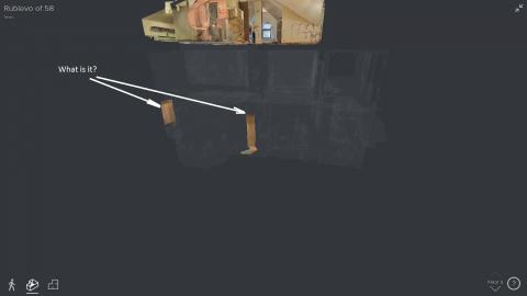 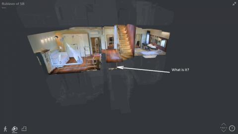 |
||
| Post 1 • IP flag post | ||

|
Jamie private msg quote post Address this user | |
| Yeah I get this often. I had a 4 level combine the basement and 1st floor as one. You can walk to it but not see it in 2d. |
||
| Post 2 • IP flag post | ||

Columbia, MO |
Showcas3D private msg quote post Address this user | |
| was there ever a solution to this issue? my last 2 scans have done this where its moving a square section in the middle of the 2nd floor to the 1st floor. I've tried moving the scans in the area to the other floor and then moving them back but that hasn't fixed the issue |
||
| Post 3 • IP flag post | ||

|
CarlosFHdz private msg quote post Address this user | |
| This is a new issue for me, I've only experienced this with the last two models I've uploaded last week, after multiple uploads and different marking, trim, some sections were corrected and others appeared. @petermatterport , is there a way to prevent this? Why does this happen if the camera uses the geometric data to create the different levels automatically? Carlos. |
||
| Post 4 • IP flag post | ||
|
Columbia, MO |
Showcas3D private msg quote post Address this user | |
| got this response back from MP after I emailed them: The software which determines how to display the levels does not actually use the level designations you assign during the scanning process, (those are specifically to assist with scanning and alignment), but rather determines the floors by evaluating the geometry of the structure. While this generally works well, it is occasionally might place them incorrectly. Engineering is aware of these occasional issues, and is investigating various improvements. I have sent them your model for further investigation. Engineering is working on a fix for this multi-floor issue coming out soon. Please keep the model on your capture app and re-upload it when I get back to you on it (very soon). The primary options at this point would be to keep the model as is, ( and retain the other benefits of the multi-floor feature) or to disable the multi-floor feature which would only remove the right corner arrow to move up and down to the next elevation. To turn off multi floor insert the query parameter &f=0 at the end of your link. Best Regards, Tim Thurman Matterport Support |
||
| Post 5 • IP flag post | ||

|
3DVUE private msg quote post Address this user | |
| supposedly the fix for this is coming in two weeks. | ||
| Post 6 • IP flag post | ||
Pages:
1This topic is archived. Start new topic?